SKY Yoga: Simplified Kundalini Exercises
- Every Saturday from 8:30-10:30am till May 25, 2025
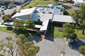
- South Ballajura Community Centre
The Ballajura Local Area Plan (Version 2) was adopted in March 2020. The plan outlines the community’s priorities, determined by the feedback received throughout the consultation period, which shows what is most important to the community.
| Priority | Update |
| Ensuring adequate amenities and infrastructure for public open space |
|
| Improving movement and access networks |
|
| Streetscape maintenance and improvements |
|
| Improve access to local social spaces and services |
|
The Ballajura local area is situated on the City of Swan’s western boundary, located approximately 14 kms north east of the Perth CBD. The local area comprises solely of the suburb of Ballajura which is bound by Cullacabardee to the north, Whiteman Park to the east and the Malaga industrial area to the south.
The 2016 Census counted 18,728 persons in the Ballajura local area with 30 per cent of residents aged less than 20 and 22 per cent aged 50 or more. Since the 2011 Census, the largest area of population growth occurred in the 50+ age groups and apart from the 30 to 34 year-olds, all other five year age groups experienced small declines. More than a third of residents were born overseas and of those 23 per cent came from non-English speaking backgrounds. Other than English, the most common language spoken at home is Vietnamese followed by Arabic and Persian/Dari.
Family households account for almost 80 per cent of all households, 56 per cent being households with children. Approximately 80 per cent of homes in the Ballajura local area are either being purchased or are owned outright and 13 per cent of homes are privately rented.
The Ballajura local area is well connected to other areas of Perth by regional transport links including Alexander Drive, Hepburn Avenue and the Reid and Tonkin Highways. It is less than 30 minutes from Perth’s international and domestic airport terminals and there are regular public transport links to the Morley and Perth bus depots which connect Ballajura with the rest of the metropolitan area.
The Ballajura area, particularly Emu Swamp and the surrounding wetlands, was used by Aboriginal people for thousands of years as a source of fresh water and a hunting ground. European settlement dates from 1829 when Ballajura was part of one of the original land grants along the Swan River. Initial development of the Ballajura area was restricted by infertile and sandy soils and was not cleared or cultivated until 1905. By 1970, the Ballajura area was part of a larger pastoral holding and remained leased as a cattle farm until 1977. Ballajura was developed as a residential suburb from 1978 and by 1981, a shopping centre, tavern and primary school complemented the area. The population increased rapidly during the early 1990s and then slowed in the early 2000s with the 2016 Census counting fewer people than the 2011 Census.
The Ballajura Local Area Plan is an important document for the City to plan for infrastructure and services, and manage change at a local level. It was developed with the involvement of local community members who worked with the City to identify specific issues affecting their community and to produce a plan providing solutions to meet the specific needs of their local area. The City appreciates the tremendous support and contribution made by community members and other stakeholders in developing this local area plan.
Major features and attractions of the Ballajura local area include:

Find out what projects are happening in your local area. Check out our projects map where you will see projects in Ballajura.